


1940s U.S. Geological Surveys
Thee maps were produced by the United States Geological Survey and depict the natural features as well as the manmade attributes of the land.

1939 City of Oxford
This map was prepared by W.L. Caldwell, C. E. for the Mayor and Board of Aldermen of Oxford, and adopted by them on June 6, 1939.

1930 Census Enumeration District
Enumeration District maps identified areas which could be covered by a single census taker in one census period (2-4 weeks for the 1930 Census). This map appears to be based on the 1912 Soil Survey Map.

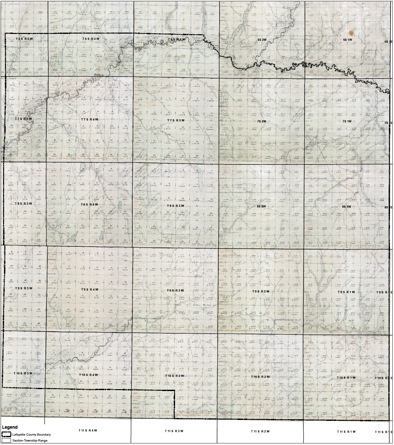
1912 USDA Bureau of Soils
This map was prepared by the U. S. Department of Agriculture Bureau of Soils and the State of Mississippi Geological Survey, E. N. Lowe, Director.

1885-1948 Sanborn Fire Insurance
These maps were created by the Sanborn Map Company to allow fire insurance companies to assess their total liability in the United States and include information such as building outlines, street names, property boundaries and natural features.

1873 Gray’s Atlas of Mississippi
This map is from the State of Mississippi Map included in Gray’s Atlas of the United States with General maps of the World, by O. W. Gray, a civil and topographical engineer.

1862 General McPherson’s Headquarters
This map shows southern Lafayette and northern Yalobusha Counties and includes Water Valley, Springdale, Yockna Station (now Taylor) and portions of the Yoknapatafa River.

1862 Cavalry Raid
This map displays many landholdings in the county, including the names of landowners listed alongside their properties and identifying houses, fields, mills, cotton presses and slave cabins.

1862 Lumpkin’s Mill to Oxford
This map shows most of Lafayette County in 1862 including the town of Oxford and the University of Mississippi, beginning just south of Oxford, and going up to Lumpkin’s Mill (now Wall Doxey State Park).
1835 Chickasaw
This map shows all of Lafayette County in 1835, and includes the Memphis to Cotton Gin Port Road, which was part of the “long trail” from Mobile to Memphis.